- Cumulus / Cumulo - puffy clouds
- Stratus / Strato - flat and smooth clouds
- Cirrus / Cirro - wispy clouds
- Alto - medium level cloud
- Nimbus / Nimbo - rain-bearing cloud

July 7, 2023
Pavle Ignjatović
Clouds are one of the most common occurences in nature. They can be seen throughout all seasons and times of the day. So, you have certainly noticed that not all clouds are the same, neither in size, shape or color. But have you ever wondered why do we have all those different types of them in our sky?

Cumulus cloud.
1. Cumulus clouds
Rounded, puffy and white.
Developed on clear, sunny days, when ground directly below cloud is heated.

Altocumulus cloud. Credits: https://www.metoffice.gov.uk/weather/learn-about/weather/types-of-weather/clouds/mid-level-clouds/altocumulus
1.a. Altocumulus clouds
White and gray patches in the sky.
Developed on warm mornings, they signal thunderstorms or temperature drop later during the day.
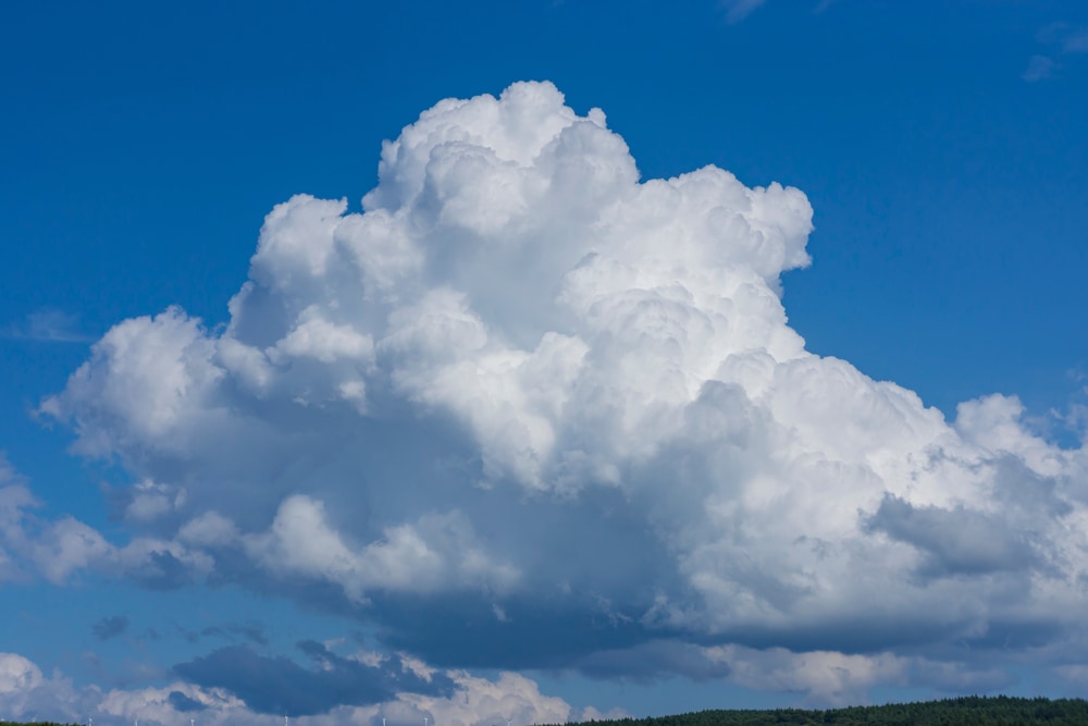
Cumulonimbus cloud. Credits: https://outforia.com/cumulonimbus-clouds/
1.b. Cumulonimbus clouds
Massive clouds with bright tops and dark bottoms.
Developed immediately before the thunderstorm.

Stratus cloud.
2. Stratus clouds
Flat and gray.
Developed on dreary days, they light mist or drizzle.
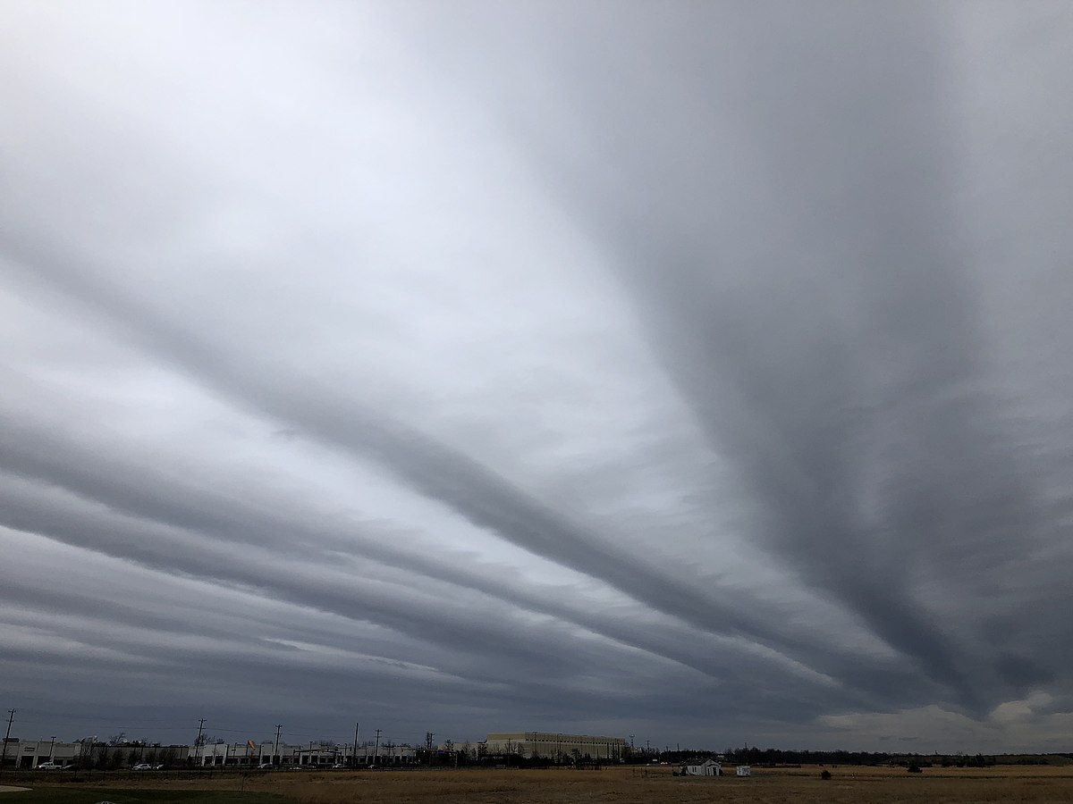
Altostratus cloud. Credits: https://en.wikipedia.org/wiki/Altostratus_cloud
2.a. Altostratus clouds
Gray sheets covering the sky.
Developed ahead of a warm front.
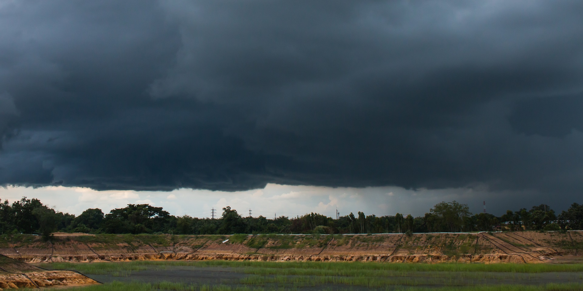
Nimbostratus cloud. Credits: https://www.metoffice.gov.uk/weather/learn-about/weather/types-of-weather/clouds/mid-level-clouds/nimbostratus
2.b. Nimbostratus clouds
Dark grey cloud in middle layers of the sky.
Developed immediately before steady rain or snow.

Cirrus cloud. Credits: https://www.metoffice.gov.uk/weather/learn-about/weather/types-of-weather/clouds/high-clouds/cirrus
3. Cirrus clouds
Thin white cloud made of ice crystals in top layers of sky.
Developed in fair weather.